Government Projects.
Multi-village water supply design, GIS-based asset management systems, and design support for road and water infrastructure — engineered for JJM, PWD, and state government delivery frameworks.
What We Do in Government Projects
Multi-Village Water Supply Networks
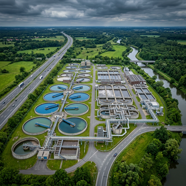
We provide end-to-end design support for integrated water supply schemes that serve clusters of villages from a common source — the core delivery model of Jal Jeevan Mission and state rural drinking water programmes. Our scope covers source assessment and water quality feasibility, intake structure design, water treatment unit layout, rising main sizing, ESR/GSR storage tank design, and village-level distribution network planning. DGPS and UAV survey data feed directly into hydraulic models and DPR preparation, ensuring design inputs are grounded in actual terrain and community locations.
GIS-Based Asset Management for Water & Road Infrastructure
Government infrastructure programmes require structured asset databases — not just for delivery accountability, but for ongoing operations and maintenance. We build GIS-based asset management systems for water supply networks (pipeline inventory, valve and hydrant registers, pressure zone maps) and road networks (pavement condition, drainage inventory, culvert register). These are delivered as PostGIS databases with a browser-accessible web GIS interface for scheme engineers, district administrators, and field teams.
Design Support Systems for Road Infrastructure
We provide spatial data-driven design support for PWD, NHAI, and PMGSY road projects. UAV corridor surveys deliver terrain models for alignment design. RTK surveys establish geometric control. GIS dashboards give project managers real-time visibility of survey coverage, design progress, and construction status across multi-km project lengths. Road asset condition mapping from UAV imagery supports maintenance priority decisions for agencies managing large state road networks.
Design Support Systems for Water Infrastructure
We use EPANET and WaterGEMS for hydraulic network modelling of government water supply systems — steady-state and extended-period simulations that verify pressure, flow, and velocity across the entire distribution network under design demand conditions. Pressure zone maps, velocity heat maps, and network performance reports support scheme design submissions, operational troubleshooting, and network expansion planning for gram panchayat and municipal water authorities.
DPR & Tendering Support
We prepare complete Detailed Project Reports for government road and water scheme submissions — formatted for central and state government review processes. DPRs include all required design drawings, hydraulic or structural analysis, bill of quantities, cost estimates (schedule of rates-linked), environmental baseline summaries, and GIS annexures. We also support tender document preparation, including specifications writing and design clarification support during tendering.
Relevant Services
FAQ
Working on a government scheme?
Send us your brief. We'll get back to you within 24 hours.