Heritage & Culture.
As-built documentation, HBIM, Gaussian splatting, and condition mapping for monuments, forts, temples, and archaeological sites — preserving irreplaceable cultural assets with millimeter precision.
What We Do in Heritage
As-Built Heritage Documentation
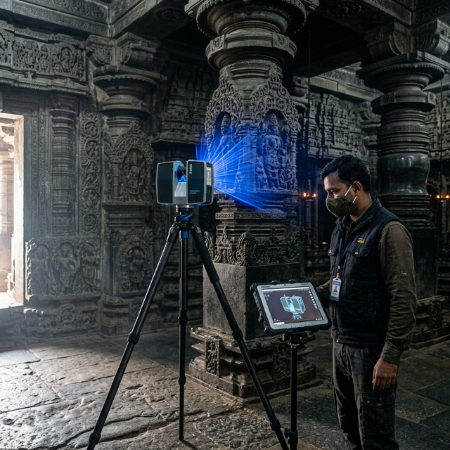
Heritage structures — monuments, forts, temples, mosques, colonial-era buildings, and archaeological sites — are irreplaceable. Yet most exist without accurate, up-to-date geometric records. We use terrestrial LiDAR scanning combined with close-range photogrammetry to produce millimeter-accurate as-built documentation: registered point clouds, orthophotos of all facades and surfaces, and section drawings that capture every dimension of the original structure as it exists today.
HBIM — Heritage Building Information Modelling
Our HBIM workflow converts point cloud data into semantically-rich, parametric models in Revit or ArchiCAD. Unlike conventional BIM, HBIM preserves the irregular geometry, material stratigraphy, and construction phasing of historic buildings. Each element is attributed with material type, historical period, condition rating, and conservation notes. These models are used by conservation architects for intervention design, by heritage authorities for permit submissions, and as archival records against which future changes can be measured.
Gaussian Splatting
Gaussian splatting is a neural rendering technique that represents a captured scene as millions of volumetric Gaussian ellipsoids, each encoding colour and opacity. When rendered, this produces immersive, photorealistic 3D visualisations with a visual fidelity that far exceeds conventional textured meshes. We deliver Gaussian splat exports for virtual heritage experiences, museum interpretation platforms, online heritage portals, and public education applications — giving audiences a genuine sense of presence within significant spaces.
Condition Mapping
Condition mapping is the systematic survey and annotation of material deterioration across a heritage structure's surfaces. We use annotated point clouds and high-resolution orthophotos to record crack patterns, efflorescence, biological growth, spalling, mortar erosion, and structural deformation. The output is a georeferenced condition map — overlaid directly on the as-built geometry — enabling conservation professionals to prioritise interventions with evidence, not estimation.
Standards & Compliance
Our heritage documentation work is aligned with international and national standards: ICOMOS Principles for the Recording of Monuments, Groups of Buildings and Sites, UNESCO digital heritage documentation guidelines, and Archaeological Survey of India (ASI) documentation protocols. This ensures that our deliverables are accepted by heritage authorities and remain valid archival records for future generations.
Relevant Services
FAQ
Documenting a heritage asset?
Tell us about the structure. We'll get back to you within 24 hours.