Geospatial Engineering.
Spatial intelligence built entirely on open-source tools — GIS mapping, web GIS platforms, satellite data processing, and geodatabase systems. No proprietary lock-in. Full client control.
What We Do
Open-source web GIS platforms, satellite imagery analysis, and geodatabase design — spatial intelligence without proprietary software dependency.
GIS Mapping & Spatial Analysis
Thematic maps, feature layers, and spatial analyses using QGIS, GRASS GIS, and PostGIS. Land use maps, infrastructure asset maps, proximity analyses, and overlay studies — all in open formats compatible with any downstream GIS platform.
Open-Source Web GIS Platforms
Browser-accessible web GIS dashboards using GeoServer and Leaflet / OpenLayers — no ArcGIS Online subscription, no proprietary licensing. Fully customisable, scalable, and client-owned spatial data interfaces.
Remote Sensing & Satellite Analysis
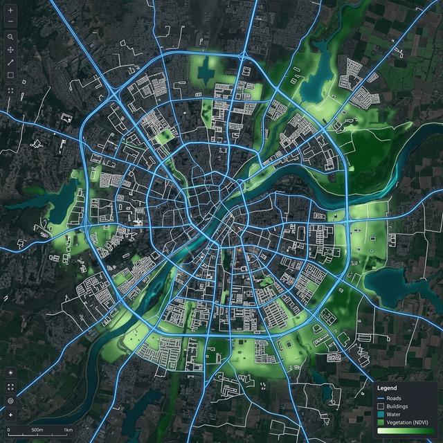
Sentinel-2 and Landsat satellite imagery processing for land use classification, NDVI vegetation analysis, flood extent mapping, and temporal change detection. Ideal for pre-project assessments and infrastructure monitoring.
Geodatabase Design & Survey Integration
Structured spatial geodatabases in PostGIS or SpatiaLite for municipal asset registries, land parcel databases, and network datasets. UAV orthomosaics, LiDAR DEMs, DGPS coordinates, and RTK data merged into unified GIS layers for engineering use.
Technical FAQ
Open-Source Intelligence.
We leverage the world's most powerful open-source spatial stack to build scalable, high-performance geospatial infrastructure without proprietary lock-in.
Send us your project brief. We'll get back to you within 24 hours.
Initialize Project